Fall Term 2025 and Spring Term 2026 Applications Now Open
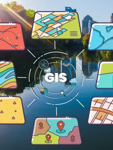
MS in Geographic Information Systems
MS in Geographic Information Systems Program Overview
The innovative GIS master’s program at Johns Hopkins University provides a solid foundation in geospatial data science, programming and application development, predictive analytics, big data technologies, and project management.
The rapidly growing geospatial technology field offers opportunities in many sectors, from government and national security to business, environmental studies, and health. With high demand, professionals with advanced degrees will be better positioned for leadership roles and the most highly regarded jobs in the industry.
Graduates of JHU’s Geographic Information Systems program work at places such as:
- National Oceanic and Atmospheric Administration
- Office of Youth Violence Prevention at the Baltimore City Health Department
- Department of Defense
- Federal Emergency Management Agency (FEMA)
- U.S. Army Corps of Engineers
- International Boundary and Water Commission
- Yellowstone National Park
- Citizens Property Insurance Corporation
Pursue Your Degree On Your Terms
Our GIS master’s program was designed for working professionals. You can take classes 100% online and choose to attend full- or part-time. You’ll also have the flexibility to take courses that best fit your career goals; we offer multiple tracks and a variety of electives.
In-Depth Article
What Can You Do With a Master's in GIS?
Geographic Information Systems have reshaped how we organize, share, analyze, and visualize geospatial information. A GIS master’s degree program equips you with a solid foundation in geospatial data technologies and science, fostering skill development in programming, prediction and analysis, and project management.


Shawn McCabe MS in Geographic Information Systems GraduateThe professors are extremely knowledgeable, helpful, and encouraging. Pursuing my degree at Johns Hopkins is one of the best decisions I have made!
Why to Pursue an MS in Geographic Information Systems at Hopkins

A World-Renowned Research University
Use of geospatial technology is surging at Johns Hopkins University. From archaeology to environmental engineering, experts across our institution are leading multidisciplinary studies, giving our GIS students access to the latest discoveries and techniques.

Expert Faculty: Learn from GIS Leaders
Our faculty members have a have a wide range of expertise, ranging from geospatial data science and machine learning, to cartography, application development, and systems engineering.

Focus Areas and Electives
Target your coursework in Advanced Geospatial Technology, Geospatial Data Science and Predictive Analytics, or GIS Programming and Application Development. Take interesting electives surrounding Drones, Python Scripting, Cartographic Design and Visualization, and Artificial Intelligence and Machine Learning in Geospatial Technology.

Capstone Experience: Research With a Mentor
Bring together everything you’ve learned in the GIS master’s program to address an issue that matters to you. Under the mentorship of a faculty mentor, you’ll demonstrate how geographic information systems can solve a real-world problem.
News in Energy Policy, GIS, and the Environment


Ready to Take Action?
GIS professionals are increasingly in demand. Take the next step to distinguish yourself from the competition with a master's degree in GIS from Johns Hopkins.