Finding Success and Satisfaction with Every Map He Makes
Published July 16, 2025
 On one wall of the office where Chris Wozniak, 23, works as a GIS Senior Specialist for Bedford County, Virginia, hangs his personal masterpiece. It is a framed map that he painstakingly created as part of his Cartographic Design and Visualization course while a student in the Johns Hopkins MS in Geographic Information Systems program. The illustration beautifully details the closures and conditions that resulted on October 4, 2024, along a portion of the Appalachian Trail in North Carolina, Tennessee, and Virginia, following the landfall of Hurricane Helene one week earlier. The map recently won Wozniak a third place in the student category of the 2025 GISCI Map Contest. His diploma, which he received in May 2025, is also destined to find a spot on the same wall.
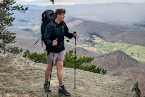
Growing up as an only child in the small, one stoplight town of Narrows, Virginia (population 2,000), Wozniak had access to the AT just a few miles from his home. Frequent hikes led to longer backpacking expeditions and a growing connection to the area. So, when it came time for him and his new bride, Megan, to exchange vows, on 5-5-25, they accessed Mount Rogers, the highest peak in Virginia, from the trail and appropriately said their ‘I dos’ while standing on the NGS survey marker at the summit. Perhaps this personal journey will also be memorialized in a GIS-aided map.
Since he first found the field during his senior year at Radford University, while pursuing a bachelor’s degree in wildlife biology and conservation law enforcement, Wozniak has been in love with the work.
“I stumbled upon this field, as many people do, and fell instantly in love,” he said. “When I decided to pursue a graduate degree, I was drawn to Johns Hopkins because of an emergency management course (he previously volunteered as a firefighter and EMT), but I came away with so much more. I love most that GIS is at the intersection of so many other fields. I like the combination of science and art that goes into mapmaking, but I also love the computer science and the coding and programming part of the field. It is super interesting to me. The instant that you press ‘run’ on your script and it comes back successful feels amazing. And when you schedule a process overnight and come back the next morning to see it completed, this is so satisfying. It feels great to know that my work is driving efficiency, enhancing data integrity, and supporting decision-making.”
Wozniak credits another course in the program, Spatial Databases and Data Interoperability, with sparking his interest in the systems integration and automation aspects of GIS. Though no two days are the same, one of the core functions of his current job have Wozniak maintaining the data that goes into correctly routing Next Gen 9-1-1 calls. The intersection of IT and GIS ensures that 911 calls and their associated information are directed to the correct public safety answering points and dispatched to the proper jurisdiction for emergency response.
As part of his JHU capstone project, Wozniak worked with the law enforcement division of the Virginia Department of Wildlife Resources and members of the Virigina Department of Conservation and Recreation to develop a small collection of dashboards to monitor conservation law enforcement across the Commonwealth. He developed the front-end of the dashboards – infusing custom data expressions, web map building, chart configuration, and spatial data visualization. He then constructed a process that leveraged a series of scripts to feed the data that powered those dashboards.
“Engineering a complete GIS solution, encompassing both the user-facing frontend while wrangling the data on the backend, all from scratch – and seeing it work completely on its own – provided me with a crazy rush of excitement and joy,” he said.
To replicate that rush, Wozniak usually winds down his workweek by devoting Friday afternoons to refactoring Python scripts, building new ones, or poking around in Bedford County’s SQL database creating views. It’s his way of decompressing, he says, and, for fun, he continues to watch videos by cartographer John Nelson and to build maps.
“I took a lot away from the JHU program,” he said. “I really must brag on the faculty – folks like Dr. Cassie Hansen and Dr. Alexander Stepanov, whose classes I loved. They are absolutely amazing. The faculty put so much work and effort into the program, and they have insane amounts of talent, knowledge, and experience. They were a pleasure to be around. I enjoyed meeting folks from all over the country in my classes.
“I love where I live,” Wozniak continued. “I love the work I am doing in state and local government, and I love that my Johns Hopkins degree opened the door to this awesome GIS field. It has propelled me further than I would have ever gotten without it.”
Attention: Students and Alumni
Are you a current AAP student or alumni and want to share your accomplishments?
Interested in pursuing a graduate degree at Johns Hopkins University?
Request information to learn more or apply here.