A Love of Information, Reimagined Through GIS
Published October 14, 2026 | Request Information
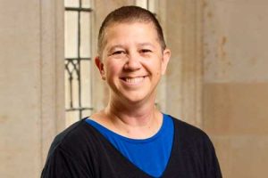 Irene Jazowick had almost forgotten about the dream she wrote down when she was seven.
Then, while cleaning out her garage years later, she found it – a small piece of paper on which the Oregon girl had answered a simple question: What do you want to be when you grow up?
A librarian.
“I was like, ‘Oh wow,’” recalled Jazowick, who navigated positions in criminal justice, photography, and law as a deaf person before deciding on librarianship. “Why not?”
Ultimately, Jazowick earned a Master of Library and Information Science from San José State University, and, in fact, became a librarian.
Today, she is a library professional at Yale University, where she catalogs and processes materials for libraries across the university. She is also a certified drone pilot and a recent graduate of the Johns Hopkins University MS in Geographic Information Systems program, a discipline that further informs her lifelong fascination with information.
Jazowick is deaf and the child of deaf parents. But she does not generally view her deafness as a barrier. Growing up, she developed a strong reliance on visual information and communication – a perspective that she believes has become an advantage in GIS, a field where maps, patterns, images, and spatial relationships are central.
“I forget that I’m deaf because I’m just going through life as myself,” she said. “But a lot of times when you lose one sense, the other senses kind of increase. I would say, I do see things differently than other individuals. I think that that is an advantage.”
That perspective informed the way she approached GIS: looking closely at information, understanding how pieces connect, and translating complexity into something people can understand.
She describes herself as an “information architect,” drawn to the details and organization that help people find and understand information.
“I have always enjoyed data – really just information in general,” she said. “I like cataloging, but I also like maps.”
That interest eventually led her to GIS.
Jazowick entered the Hopkins GIS program while continuing her work at Yale. For her, the field offered a way to take the information she had spent years organizing and look at it from a different perspective.
“When I look at a map, you know, it’s always telling me a story, and I have to figure out what that story is,” she said.
The Hopkins program expanded her understanding of what those stories could be. She explored cartography, emergency management, and other applications of GIS, discovering how the technology could complement fields ranging from libraries and law to sports.
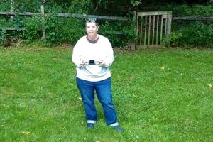
Technology and accessibility tools have also helped make education and work more accessible to her. At Yale, she uses captions, live transcription, and interpreters for meetings. During her Hopkins courses, she used captions, chat, and email, and the university provided a sign-language interpreter for her field experience in her drone course.
She has also taught American Sign Language to her Yale colleagues, including library-specific vocabulary, and serves on the Yale Library DEIA Advisory Committee and the Yale Rep Theatre Accessibility Advisory Board.
Those interests in information, visual storytelling, accessibility, and emergency management came together in her Hopkins capstone project.
For her final project, Jazowick created the Washington County Emergency Response Geospatial Hub, an emergency-management resource focused on Washington County, Oregon, where she once lived.
The region faces a range of natural hazards, including earthquakes, volcanoes, floods, and mudslides. Jazowick approached the project from two perspectives: that of an emergency-management professional who needs useful information quickly and that of a resident who needs to understand what is happening and what to do.
Her goal was to organize large amounts of information – including what she calls the “sub- and sub-sub-information” – into a resource that was easy to navigate. Clear maps and straightforward language were central to the project.
The result earned recognition from the faculty in the Hopkins GIS program, who named Jazowick a recipient of the 2026 Outstanding Student Award. Faculty cited her technical ability, intellectual rigor, and capacity to engage with complex problems, particularly in her final project.
For Jazowick, the project was also a chance to combine the skills she had developed across her career: organizing information, understanding how people access it, and using maps to make it more useful.
Her capstone mentor, Chris Ferner, who taught Jazowick in both cartography and emergency management, proved invaluable throughout the process.
“Fern was amazing to work with,” Jazowick said. “She gave great feedback.”
Jazowick is still exploring where her two areas of expertise might take her next.
She knows she wants to find a way to combine GIS with library and information science, but she is also curious about other possibilities. Her work with drones has opened another door.
After taking a Hopkins course in drones and geospatial decision-making, she passed the FAA Airman Knowledge exam and became a certified drone pilot. She studied weather and airspace, drone technology, LiDAR and thermal imaging, and gained hands-on experience flying drones. She now uses her own drones to practice and has considered doing drone work on the side, including real estate imagery.
After earning two master’s degrees, Jazowick is ready to step away from the classroom and see where her combined expertise can take her next.
“I’m a dreamer,” she said, referencing her seven-year-old self.
Young Irene could not have known where that dream would lead – through libraries, across disciplines, onto maps, and ultimately into the skies.
Now she has the tools to chart whatever comes next.
Attention: Students and Alumni
Are you a current AAP student or alumni and want to share your accomplishments?
Interested in pursuing a graduate degree at Johns Hopkins University?
Request information to learn more or apply here.